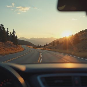
Most road trip advice is about efficiency. The fastest route. The fewest stops. The straight line between where you are and where you want to be. I understand the impulse. Time is limited, and the highway is predictable in a way that back roads are not.
But here is what I have learned after enough weekends spent wandering: the extra 40 minutes is rarely a cost. It is an investment. It buys you the curve of a road you didn't know existed, a stretch of quiet that resets your shoulders, and occasionally a view that makes you pull over just to stand still and look at it. These are the detours that have earned their extra time. None of them are secret. But all of them are easy to skip if you don't know what you're missing.
The long way around Kenosha Pass
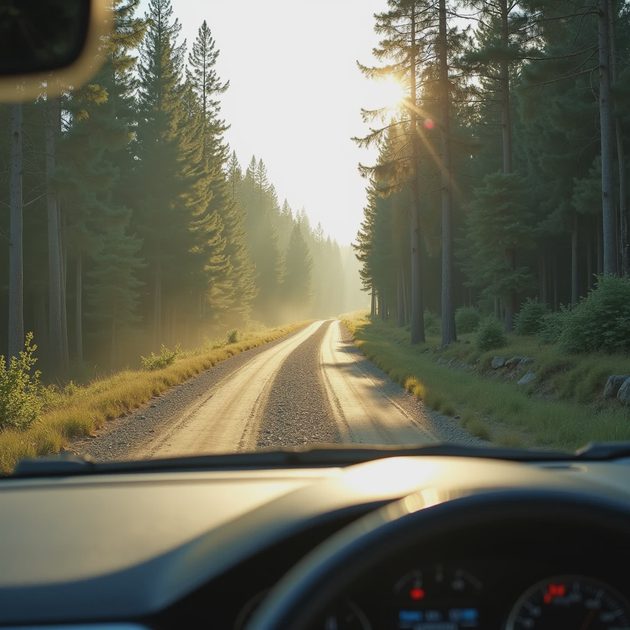
The main route on Highway 285 over Kenosha Pass is already good. It climbs through pine forest and opens suddenly onto the South Park basin, which is the kind of view that makes passengers reach for their phones. Most people stay on 285 and miss the dirt road that peels off just before the summit.
That road is County Road 126, and it loops through the forest on the north side of the pass before rejoining the highway a few miles later. It adds maybe 30 minutes. The surface is graded gravel — fine for any car that doesn't sit too low — and the trees press in close enough that the light comes through in narrow shafts. There is one clearing where the entire basin opens up below you, and if you stop there, you will hear nothing but wind and the occasional bird.
If you only remember one thing
Go slow. Not because the road demands it, but because the point of a detour is not to rejoin the highway as fast as possible. The point is to notice where you are.
The rim road above the Colorado National Monument
The main drive through Colorado National Monument is Rim Rock Drive, and it is spectacular enough to justify the entrance fee all on its own. But most visitors drive the monument road, take their photos at the overlooks, and then continue toward Fruita or Grand Junction without ever knowing there is another option.
Just outside the east entrance, a lesser-known road called Little Park Road climbs the back side of the monument and runs along the rim from above. It is unpaved in sections but passable in a standard car with a little patience. The views drop away to the east — the Grand Valley spreading out in a patchwork of orchards and small towns, the Book Cliffs rising in the distance. What you lose in the classic monument vistas, you gain in solitude. I drove it on a Sunday morning in October and saw exactly two other vehicles in an hour. On Rim Rock Drive, that same hour would have included a dozen RVs and a line at the best overlooks.
Worth the extra mile
If you time it for late afternoon, the light on the sandstone is the kind of orange that no photo quite captures. I have tried. The photos are fine. The memory is better.
The farm roads between Longmont and Lyons

This one feels almost too small to mention, but I am mentioning it because the small ones often deliver the most. Highway 66 between Longmont and Lyons is the obvious route — a straight shot with fields on both sides and the foothills approaching as you head west. It is pleasant. It is also busy.
The detour is a network of farm roads that run parallel to 66, just to the north. Take County Road 26 west from Highway 287, then wander south on any of the numbered roads that cross the fields. The pavement is good, the traffic is almost nonexistent, and the view of Longs Peak filling the windshield is the same view that Highway 66 offers, except here you can stop in the middle of the road to look at it without anyone honking. Don't actually stop in the middle of the road. But you could pull over, which I have done, and sit with the engine off while the irrigation pivots click in a nearby field.
Best time
Late summer evening, when the light goes gold across the fields and the mountains turn that impossible shade of purple-blue that looks fake in photos but isn't.
The river road through the Poudre Canyon alternative
The main drive up the Poudre Canyon on Highway 14 is well known and well traveled. It follows the Cache la Poudre River through a narrow canyon that gets better with every mile. But the stretch between Ted's Place and the canyon mouth on Highway 287 is just a connector — a means to an end. Most people drive it without thinking.
Stove Prairie Road branches off Highway 14 a few miles up the canyon and climbs into the hills above the river before dropping back down to meet the highway further west. The road is partially unpaved but well maintained. What it offers is elevation — a view of the canyon from above, through meadows and stands of aspen that turn the whole hillside gold in late September. The detour takes about 40 minutes, and when you rejoin the highway, the canyon feels like a different place. You have seen it from above. You have earned the river.
When the detour becomes the drive
I have friends who treat detours like interruptions. They are route optimizers, always calculating the shortest distance and the fastest path. I used to be one of them. Then I took a dirt road north of Kenosha Pass on a whim and spent 40 minutes driving through light and shadow that the highway could not offer.
The part nobody tells you about scenic detours is that they change your relationship to the road. You stop driving toward something and start driving through something. The destination becomes less urgent. The extra time becomes the whole point.
If you only remember one thing: Take the 40 minutes. You will not arrive much later. But you will arrive a little different.


Letters
No letters yet — be the first to write.